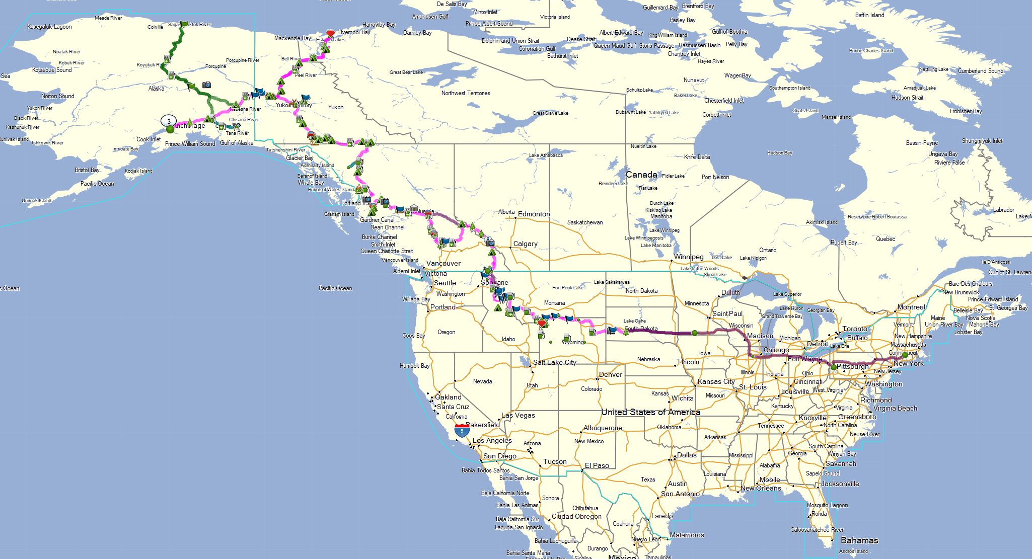
I tend to prefer not locking myself into a tight schedule for long trips, but the length and complexity of a trip like this do require some amount of planning and preparation to be successful. Is it something I can realistically take time off work to do? Which sections have limited services and will require me to carry extra fuel, food, and water? What’s the best way to time leaving after the snow melts in the Rockies and before wildfires and mosquitos are at their peak in Nothern Canada & Alaska? Where can I get tires and service the bike?
I also want to make sure this trip feels like a vacation. I’ve done trips where I just burned miles day after day, taking in the sights from the road. Sometimes it’s a necessary evil, but I didn’t want this trip to feel like that. To buy more time on the road, I’m planning to truck the bike to Badlands National Park in South Dakota for the official start and to fly myself & the bike home from Anchorage.
To make sure I keep a relaxed feel to trip, I set a few route & trip guidelines for planning:
- Average 200 miles of riding per day
- Camp 5-6 nights per week
- Take at least one rest day per week
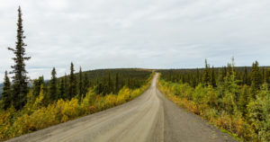
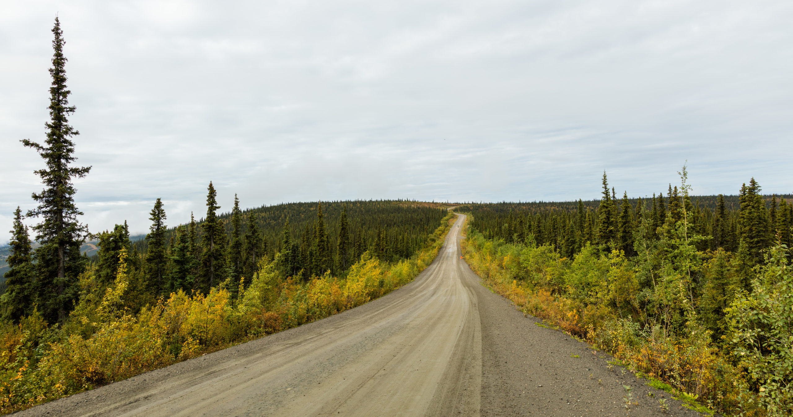
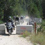
- Prioritize unpaved roads
- Avoid interstates
These guidelines should give me time to explore the varied towns and terrains I’ll be experiencing on the trip. I should have time to have an extra cup off coffee in the morning, make camp (or check into a hotel) in the daylight, tend to the bike, do laundry, and reflect on the trip as I go without feeling super rushed.
This structure also gives me flexibility. If I get sick, need to fix the bike, need to wait out inclement weather, or just want another day off I can do any combination of increasing the mileage, staying in a hotel, moving rest days around, or taking larger roads to make up the time. There are also several side trips & extra legs to the route that I can cut out as-needed.
An obvious overall route took shape pretty quickly by laying out points of interest (POIs) and major stops using vlogs and books from other adventure riders. I applied my 200 mile average range goal (including availability of accommodations) to estimate the time it would take to complete the trip. The final step was searching along the route to create way points for as many camp sites, gas stations, and motorcycle shops as I could to make sure I knew where I had options and where I needed a set plan for fuel & services.
The hard anchor points I have in the timeline are the start date from South Dakota (because Tori’s mom is flying out to meet us and they’ll road trip home together) and the flights home for myself and the bike from Anchorage. I’ll also likely need to book my stays for major national parks (Yellowstone, Jasper, etc.) and the Canada Day long weekend in advance. Other than that, the goal will be to plan a few days at a time while I’m on route, using the planned outline to make sure I’m not risking my flights home.
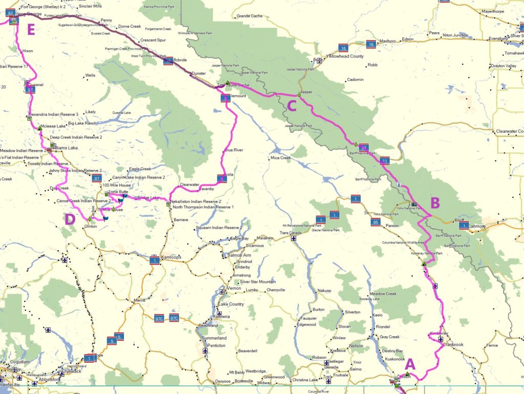
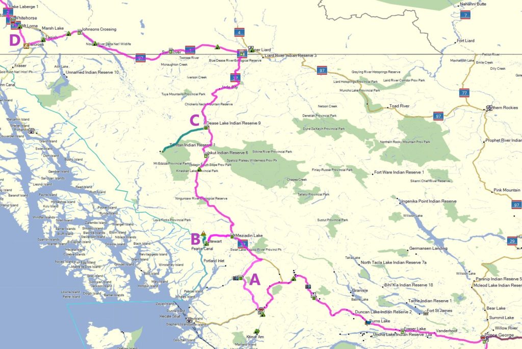
Route Key:
- Pink: Intended Route
- Teal: Optional side trips if I’m keeping to schedule
- Dark Pink: Drive out & shorter bypasses if I need to make up time
Route Breakdown
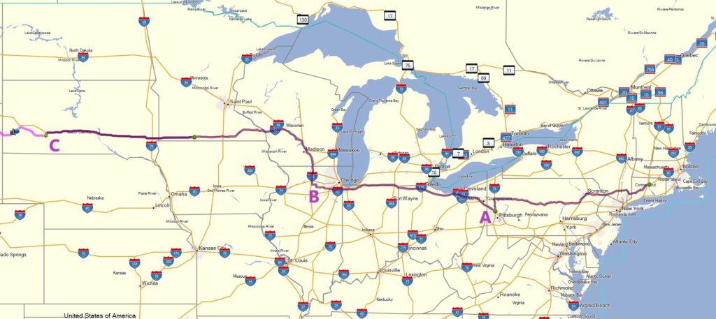
Leg 0: Connecticut to South Dakota
4 Days / 1,900 Miles. The first stage of the trip is getting myself, Tori, and the DRZ to the Badlands to start the trip. We’ll head out from CT and need to make it to SD in time to grab Tori’s mother from the airport in Rapid City.
Major POIs:
- Pittsburgh, PA: Spending the first night with my family in my hometown
- Sandwich, IL: The final town of Sandwich in the Sandwich Quest
- Badlands National Park, SD: The official start of the trip. Tori’s mom will meet us here, and after a day of exploring as a trio I’ll start my journey West before they head South for a trip to Crater of Diamonds State Park in Arkansas.
Leg 1: Badlands, SD to North Fork, ID
3 Days / 1,000 Miles / 1,000 Total Trip Miles
The motorcycle trip starts when I head West out of the Badlands and cross the Great Plains to get to the Rocky Mountains in Montana & Idaho. There’s some higher than average mileage front loaded into these days, but I did that to buy myself a more relaxed pace later on.
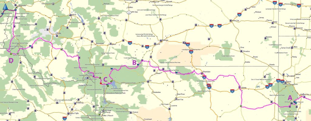
Major POIs:
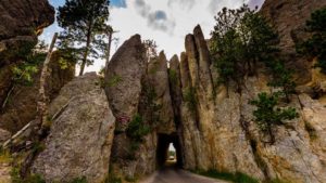
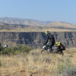
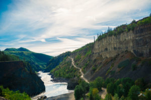
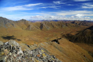
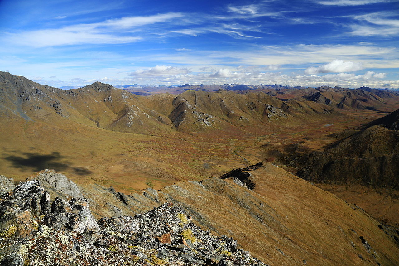
- The Black Hills: The first day starts off with twisty mountain roads and alien-looking geological formations before descending down into the plains of eastern Wyoming.
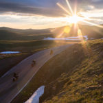
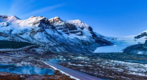
- Beartooth Highway: After spending the night in Sheridan, WY, the roads gain elevation quickly as I start to enter The Rockies and scenic mountain passes. The views and curves should make up for the long day on pavement.
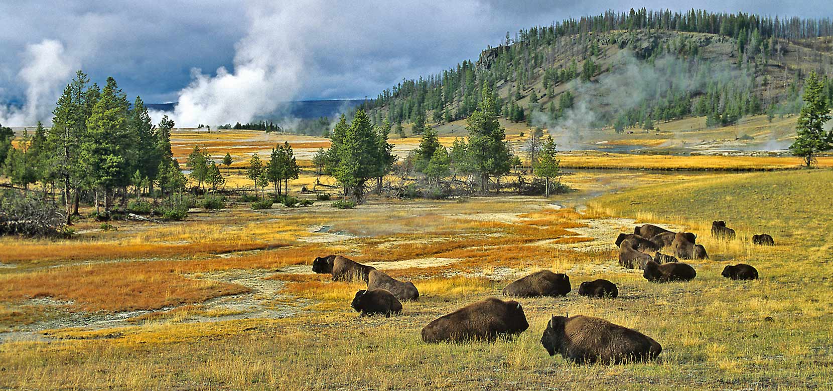
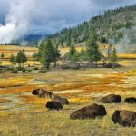
- Yellowstone National Park, WY: There’s no good non-highway route to get from SD to ID without going through Yellowstone, which makes up the entire northwest corner of WY. I’ll spend the night on the lake, but likely won’t do too much sightseeing since Tori and I plan on a proper Yellowstone trip at some point in the future.
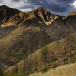
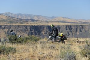
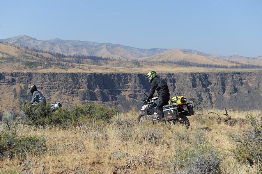
- Salmon-Challis National Forest: The sprint West ends near North Fork, ID, where I’ll be able to start slow down the pace and pick up my first unpaved miles through the National Forest.


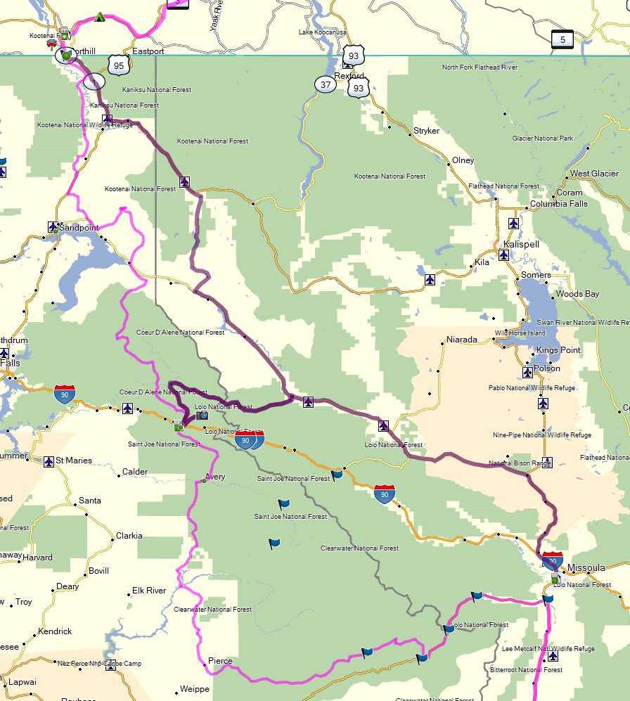
Leg 2: Idaho Backcountry Discovery Route (IDBDR) to Creston, BC
3 Days / 585 Miles / 1,585 Total Trip Miles
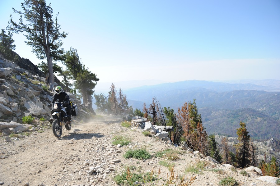
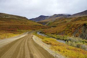
Once I hit Lola, MT, I’ll follow the second half of the IDBDR North to the Canadian Border. I’m not planning on taking the risk of doing any gnarly trail riding on this trip and the Idaho BDR is rated as one of the easiest BDRs. The fast gravel & dirt roads should let me explore the historic & scenic route without sacrificing any time, and there are plenty of areas for dispersed camping in the national forests along the route.
The dark pink alternate path is a Garmin-generated alternative in case the snow still hasn’t melted on some of the mountain roads, but I should hopefully be fine in the last week of June.


Leg 3: Southern British Columbia & Alberta
5 Days / 985 Miles / 2,574 Total Trip Miles
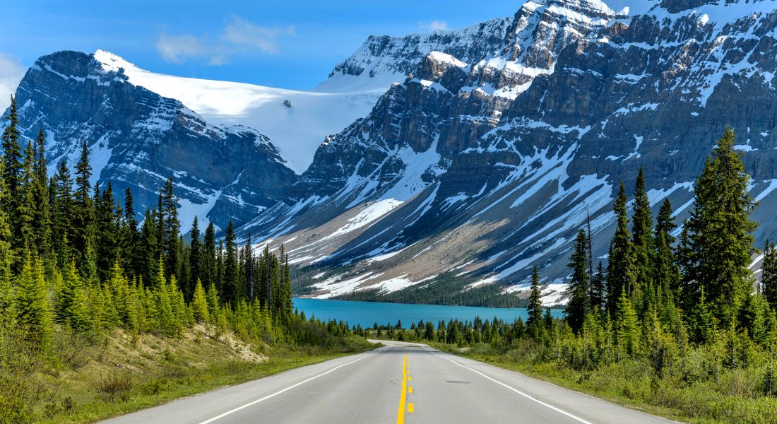
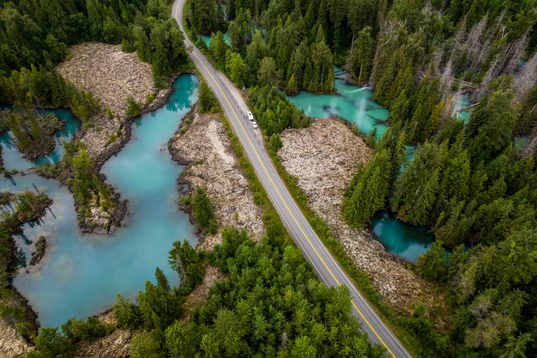
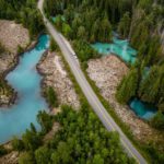
Once I cross the Canadian border and enter British Columbia, I’ll continue North through Radium Hot Springs, BC to ride the length of the Icefields Parkway between Banff and Jasper National Parks. I’ll be mostly back on pavement for this section, but after Jasper I’ll descend into to the Central Plateau of BC where I can hop on some dirt forest service roads. I plan to explore the Interlakes district (and Sheridan Lake) before heading to Prince George, BC for rest and my first planned service stop for the bike.
Major POIs:
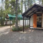
- Creston, BC: After the sprint West and IDBDR, I’ll take my first planned rest day at a local (motorcyclist owned) AirBNB.
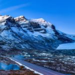
- Banff National Park, AB: The next leg routes through Radium Hot Springs, BC before riding up the spine of the Canadian Rockies on the scenic Icefields Parkway connecting Banff to Jasper. This toll road is full of mountain vistas, glaciers, lakes, and campgrounds (and plenty of RV traffic)
- Jasper National Park, AB: I’ll camp in Jasper or one of the nearby provincial parks before heading South. I’ll be in this area right around the Canada Day long weekend, so depending on timing I may cut directly to Prince George on the Trans Canada Highway to buy supplies & service the bike (dark pink route).
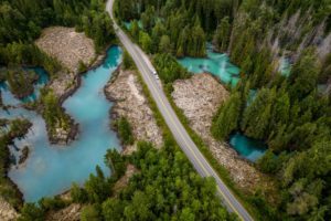
- Interlakes District: My intended route will take me Southwest from the Rockies into the Interlakes district of Cariboo County. After spending the night near Sheridan Lake, I’ll continue mostly South on unpaved forest service roads before turning North to Prince George. Williams Lake is a mid-sized town and offers another opportunity for buying oil & supplies for the bike if I won’t hit Prince George before the holiday weekend.
- Prince George: One of the last major towns on my way North, Prince George will be a chance to resupply myself and make sure the bike is serviced & ready before heading into increasingly remote areas.


Leg 4: Northern British Columbia to The Yukon
8 Days / 1,433 Miles / 4,007 Total Trip Miles
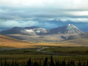
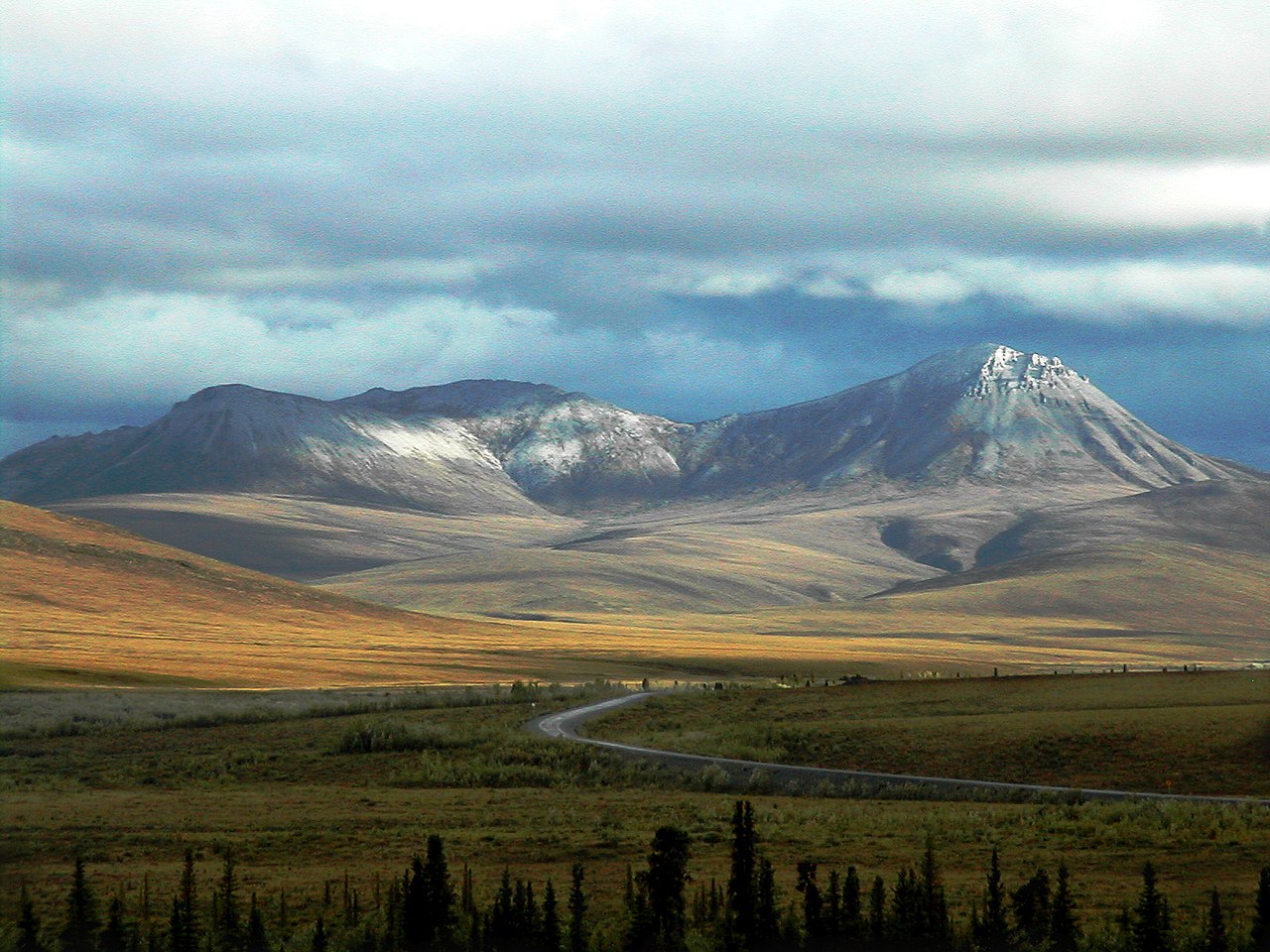
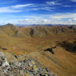
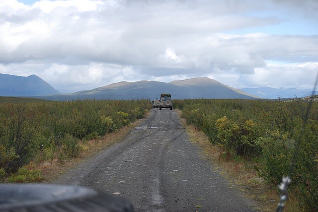
After Prince George, I’ll continue West across BC’s Central Plateau until I hit the Coastal Mountains near Kitimat, BC. Riding North along the Coastal Mountains, I’ll have some side trips to explore volcanoes, gorges, and glaciers. The Coastal Mountains and Rockies eventually meet in the Cassiar Mountains, which is where I’ll cross the border into The Yukon. This is where the distances start to become more vast, the terrain more rugged, and the population density starts to plummet.
Major POIs:
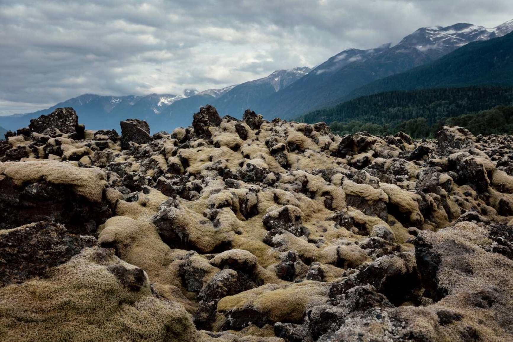
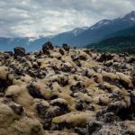
- Nisga’a Memorial Lava Bed, BC: I’ll skip the very beginning of the Cassiar Highway to see the remnants of Canada’s most recent volcanic eruption. The Tseax Cone erupted in 1700, leaving expansive lava flows and damming & altering the Nass river (killing an estimated 2,000 people, mostly members of the Nisga’a First Nation).
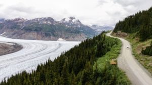
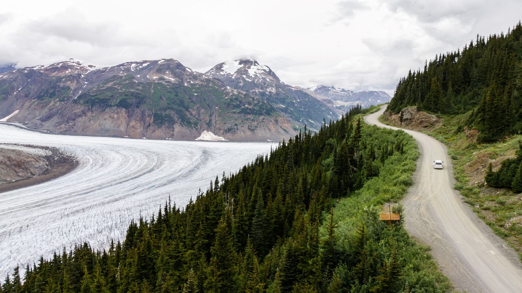
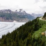
- Salmon Glacier, BC: A huge glacier, it’s technically located in Canada but only accessible by a road that starts just over the US border in Hyder, AK.
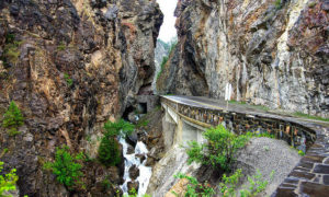
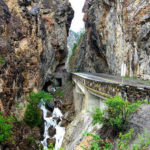
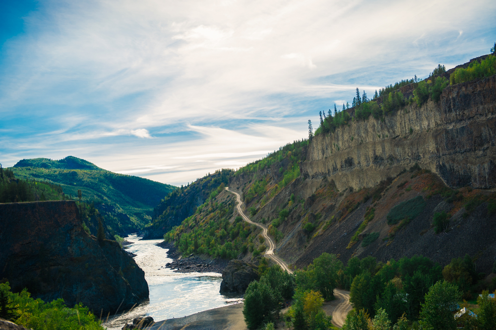
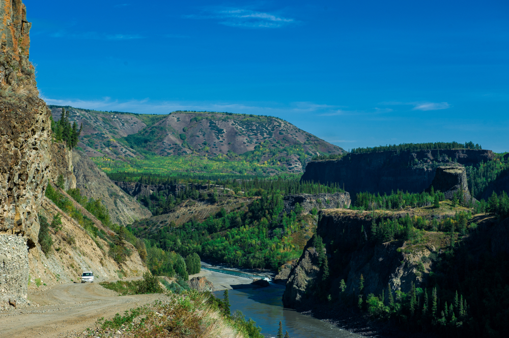
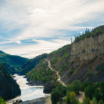
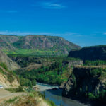
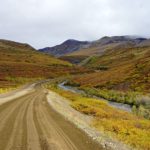
- Telegraph Creek Road, BC: A famous road for adventure riders, Telegraph Creek road is a steep (up to 18% grade), winding, unpaved road following the rim of the Stikine River Canyon. The 70 mile road ends in Telegraph Creek, the most remote village in BC accessible by road.
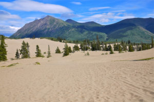
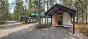
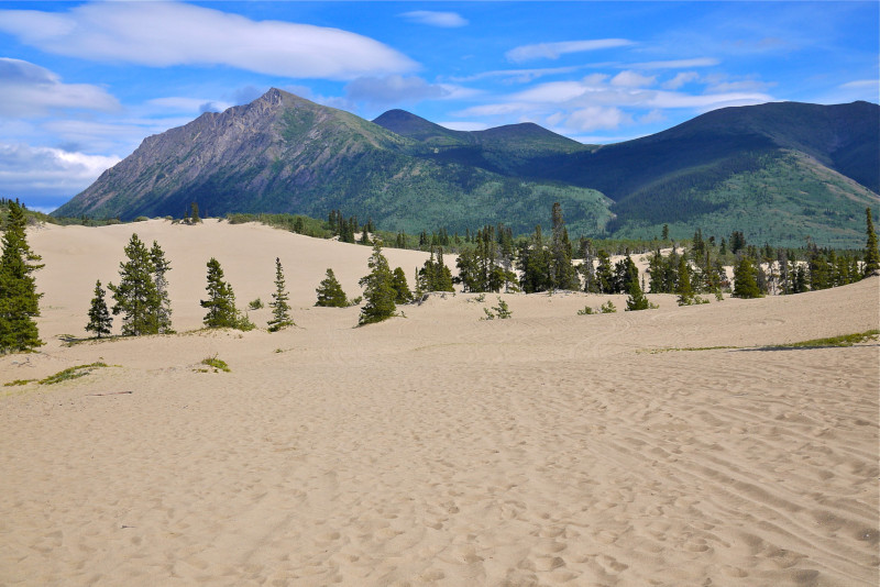
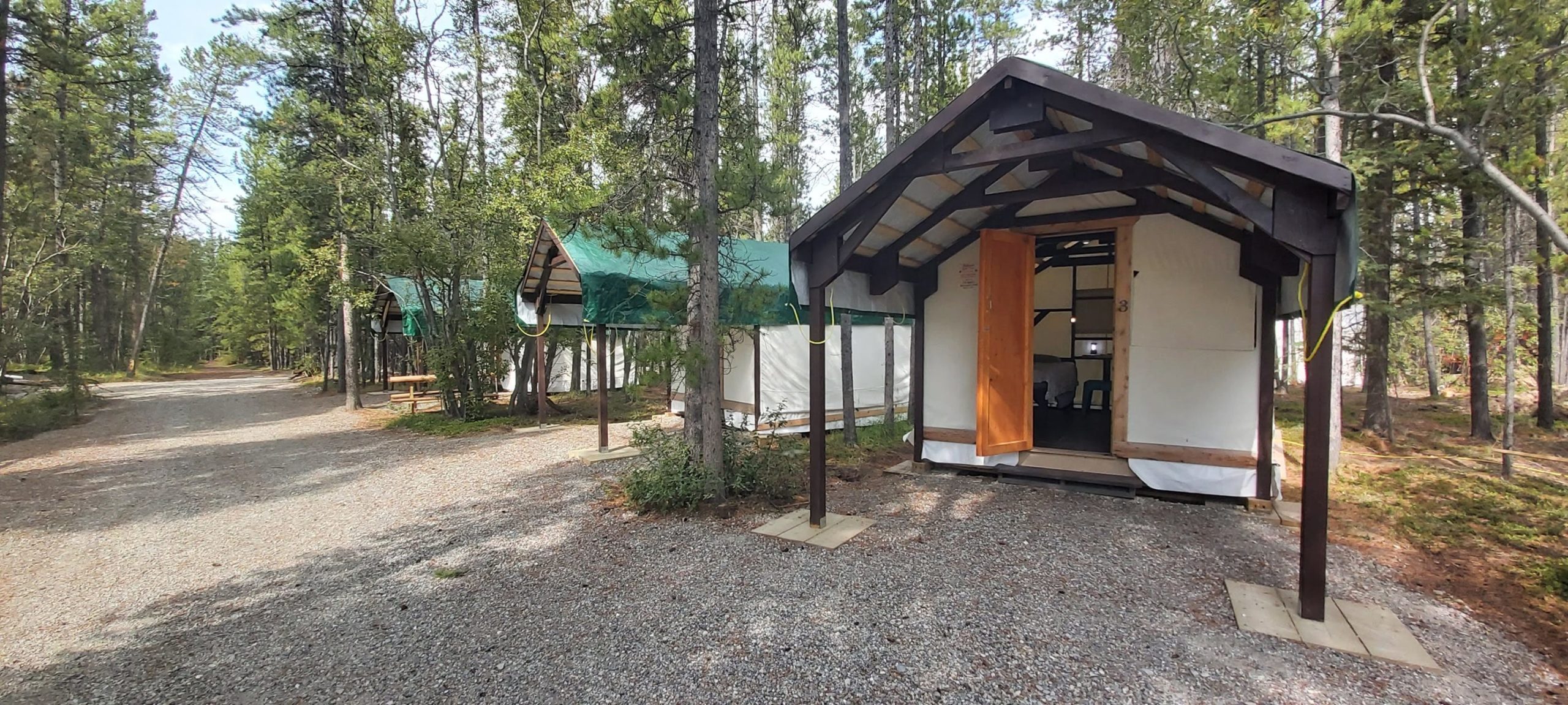
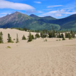
- Whitehorse, YT: I’ll pick up the Alaska Highway running west once I cross into The Yukon. I play to ride one long day (~400mi) to reach Whitehorse, the last major town before I head into the Arctic. The marathon day should buy me a chance to arrange for tires & an oil change on a rest day. I’ll spend two nights at the Yukon Motorcycle Park, a motorcycle only campground just outside of Whitehorse. I’m also hoping to be able to carve out time for a trip south to Tagish and the Carcross Desert, a 6 square mile of arid desert in the middle of the Canadian wilderness.


Leg 5: The Yukon & Northwest Territories
6 Days / 1,618 Miles / 5,625 Total Miles
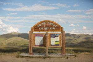
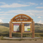
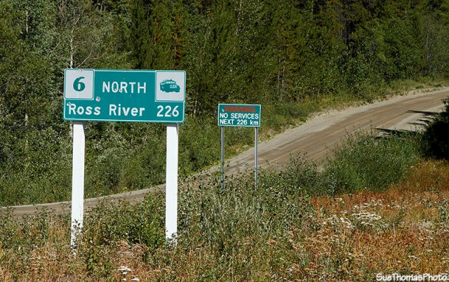
Heading North out of Whitehorse, YT, I’ll continue through Stewart Crossing to the start of the Dempster Highway. The Dempster is the unpaved, 575 mile stretch of highway that crosses the Arctic Circle and will take me to the Arctic Ocean in Tuktoyaktuk, NWT. The dirt & gravel highway is the only public road in North America which reaches the Arctic Ocean and has limited services, multiple ferry crossings, and can become impassible in inclement weather (at least for a motorcycle). After the Dempster I should be able to take a day off in Dawson City to rest before I head back into The States.
There are a number of provincial parks in The Yukon and Northwest Territories which have self-service registration and free firewood. This should help keep my pace flexible and avoid the temptation to ride all night — the sun doesn’t actually set this far North in June & July.
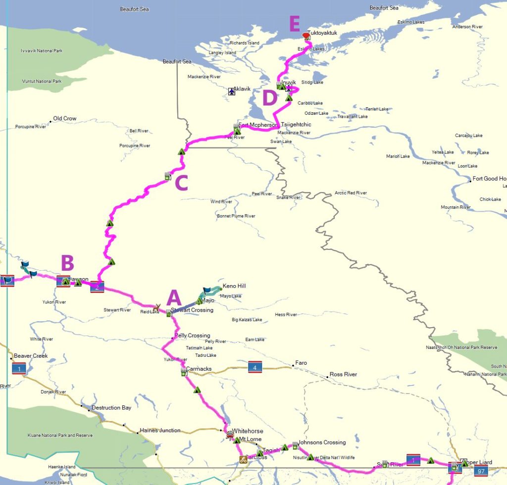
Major POIs:
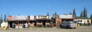
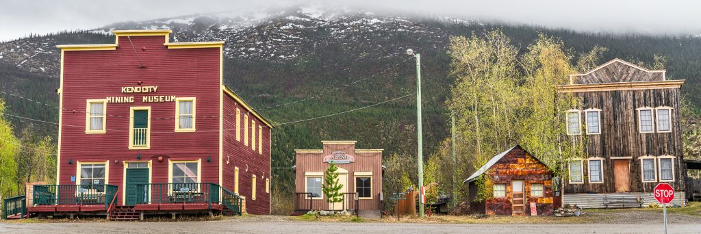
- Keno City, YT: An old mining town only accessible by a rugged dirt road, Keno City is a one-street town with 20 permanent residents, a mining museum, two bars, and bunkhouses which are still used by prospectors looking for gold. Keno City isn’t on my main route, but I’ll hit it if I’m ahead of schedule.
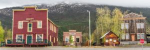
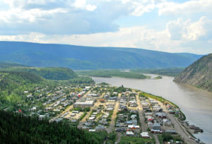
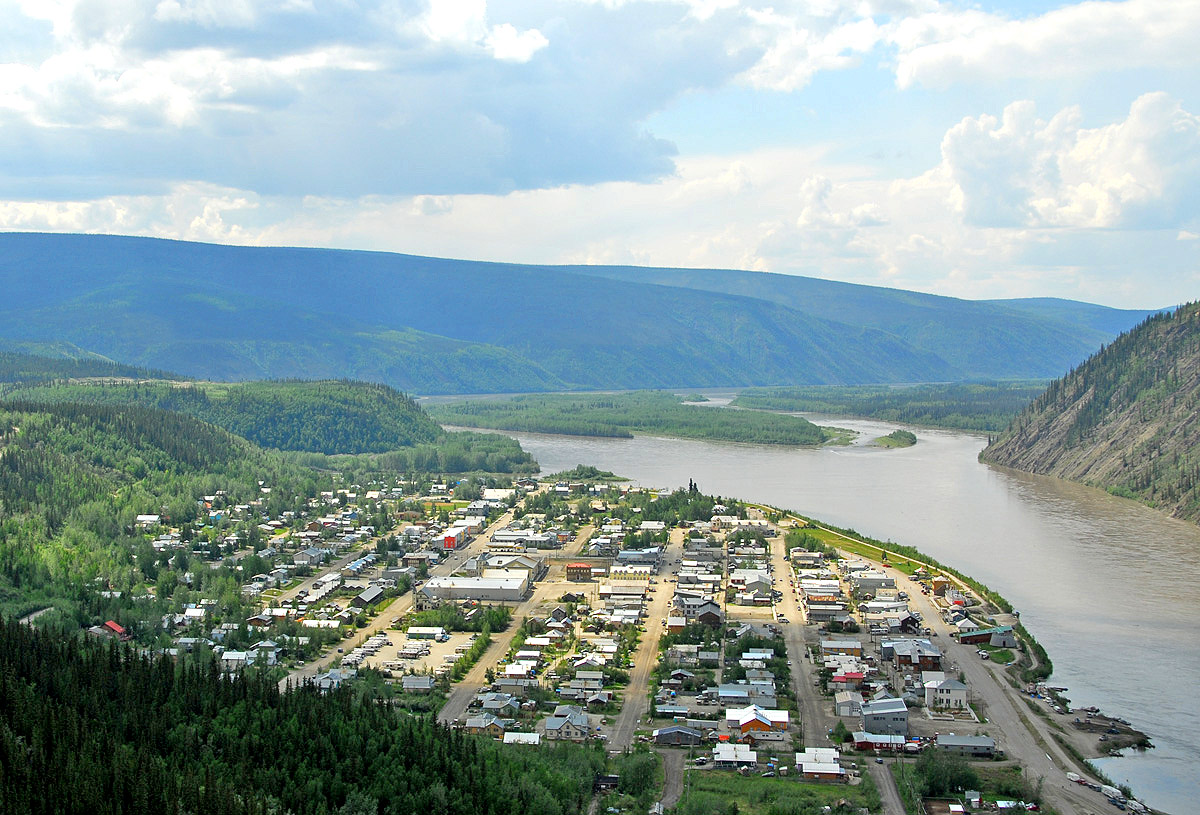
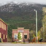
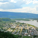
- Dawson City, YT: A remnant of the Klondike Gold Rush, Dawson city still has dirt streets and retains much of it’s historical feel and appearance. It’s mostly a tourist town now, but it remains a hub for gold exploration & mining. Depending on my fuel and timing situation, I’ll likely skip Dawson City on my way up the Dempster, but rest here on my back back from Tuk.
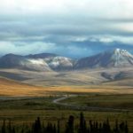
- Eagle Plains, YT: The first major fuel & food stop on the Dempster, Eagle Plains is 254 miles from Dawson City. The geography transitions from rugged mountains to boreal forest as the road heads out of Tombstone Mountain Provincial Park in the first few hundred miles of the Dempster.
- Inuvik, NWT: The only town in this region of the Northwest Territories, Inuvik was the previous end of the Dempster before the last stretch to Tuktoyaktuk. Inuvik also marks the transition from boreal forest (taiga) to arctic tundra.
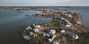
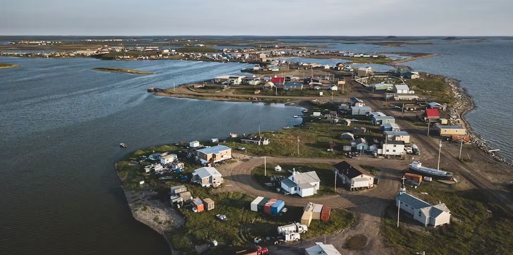
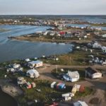
- Tuktoyaktuk, NWT: The only place in North America where the Arctic Ocean is connected by an all-weather (public) road, Tuk is the literal end of the road and the crown jewel of the trip. Notably, Tuktoyaktuk was the first indigenous settlement in Canada to officially reclaim its traditional name.


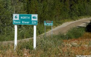
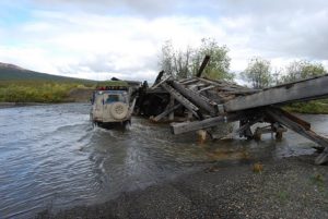
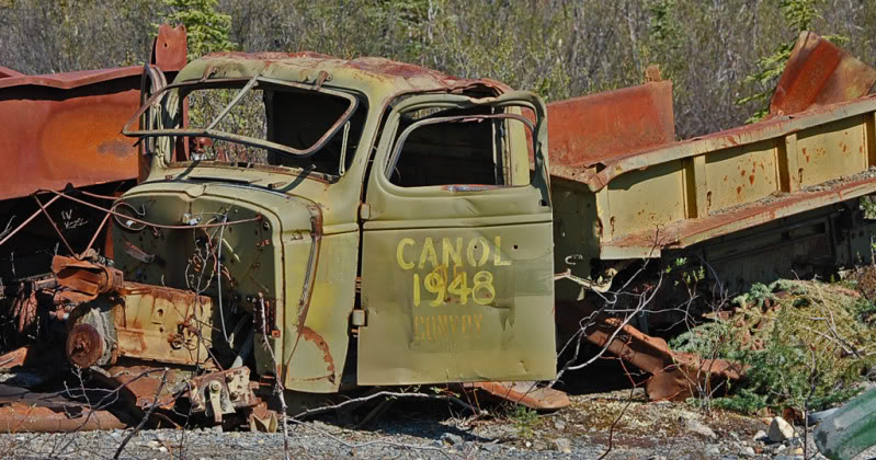
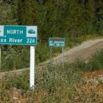
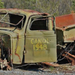
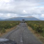
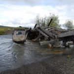
Route Update: I didn’t have time to grab screenshots of the new GPS route, but I recently rediscovered the old Canol Road, stretching from Johnson’s Crossing to the NWT Border via Ross River. Originally constructed to serve an oil pipeline stretching all the way to Norman Wells in WWII, the road has significantly deteriorated since being abandoned shortly after construction. Because of the speed it was abandoned, the road is a living museum of old workshops, pump houses, and construction vehicles that were left to decay in the sub-Arctic wilderness.
The route is now considered three segments: the South Canol is a well-graded dirt road from Johnson’s Crossing to Ross River; the North Canol is easily passable two-track from Ross River to the NWT Border; and the Canol Trial which is only navigable by foot/bicycle and rafts. If I have a few extra days, I’m hoping to hit the South & North Canol but will stop short of attempting the Canol Trail solo.


Leg 6: Alaska
5 Days / 830 Miles / 6,455 Total Miles
After a rest day in Dawson City, I’ll head Southwest on the Top of the World Highway towards Anchorage. If I’m rained out of taking the Dempster Highway, the Dalton Highway is my back-up plan to get to the Arctic Ocean in Alaska. I hope to have enough time to head East on the unpaved road to McCarthy, AK to see the Kennecott Mines before the final stretch of paved roads into Anchorage.
Major POIs:
- Top of the World Highway: A mostly unpaved route through Chicken, AK and Tok, AK. The road is notable for the quirky, remote towns it passes through and the fact that it was built on the ridgeline of the mountains, giving spectacular views in both directions.
- Alternate Route to the Dalton Highway: My back-up plan to see the Arctic Ocean. The Dalton is my second choice of the Dempster because it’s the only haul road for the oil fields in Deadhorse. It has heavy truck traffic, 129 miles of pavement, and doesn’t actually end at the ocean (you need to pay for a Haliburton tour bus to take you to the coast).
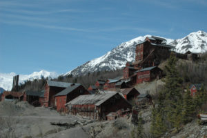
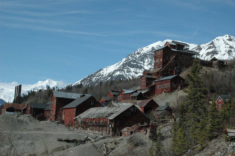
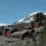
- Kennecott Mines: At the end of a long, rugged, dirt road, the Kennecott Mines were once one the world’s largest copper mines. The Kennecott Mines are now a National Historic Landmark in a stunning, remote location.
- Anchorage, AK: The trip ends at The Motorcycle Shop, a world-famous motorcycle dealership & service center in Anchorage. They’ll crate the DRZ for me and send it on its way while get on a plane for my ride home.